Racing starts today!
Our Thursday Evening racing series starts this evening at 6 pm! See below for more information. We urge members and everyone to check it out. Racing is one of the best ways to improve your sailing skills. You will quickly realize that over-trimming your sails really does make you slow, plus it’s lots of fun!
Weather or not to head out?!!
The first thing we teach our students about what to consider before heading out is the Weather. Nothing else has as great an impact on the safety of you and your crew.
In this area, the 2 common occurrences to watch out for are strong thunderstorms, and a strong cold front, such as we may get this Saturday. Of course, many summer days include the chance of thunderstorms, so by itself, the chance of thunderstorms is not enough to keep us ashore. Here is a more in depth look at these two weather phenomena.
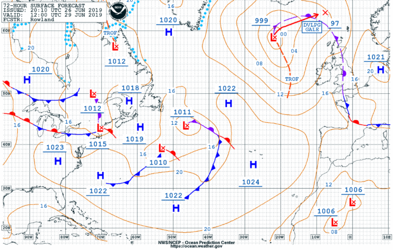
To start off, it’s important to understand that the Jet Stream in the upper atmosphere, a fast moving river of air the encircles the globe typically somewhere in the 30 to 60 degree north region, both creates our weather, and steers the weather that has already formed. The jet stream runs from west to east, which is why our weather in general comes from the west. Sometimes the Jet Stream is heading more north or south, and it will steer the weather in that direction. The 500 MB charts (500 millibars is half way up in the atmosphere, and where the Jet Stream is the strongest), provide some valuable insights for where the weather is headed.
To check out the local weather charts, go here;
Noaa weather charts
Its also useful the realize that the weather forecast is the product of a local NOAA forecaster who is looking at the results of several different computer model runs. NOAA supercomputers run simulations on what the Jet Stream will do and the resulting local weather that results. Of course, there is always some uncertainly with the forecast, and this is best discussed in the Forecast discussion which Noaa includes on both the Marine, Mobile and desktop site. The forecast discussion will initially seem like lots of esoteric info on the different models, but after reading it a few times, you can pick up on the forecasters confidence in the forecast, which is high if all the models agree on what will happen. Here is the link for the Marine version of the NOAA forecast;
NOAA Marine Weather
The forecast discussion also includes a discussion of the likely winds in the Aviation section, and a discussion of the Marine weather forecast, all great info.
Strong Thunderstorms
The typical summer thunderstorm is formed as hot moist air gets lifted into the atmosphere. The sun thus plays crucial part in imparting the energy, and cloudy or overcast days are not conducive to normal thunderstorm development. The Thunderstorms that effect us typically are formed over PA and NJ. Certain clouds are well positioned and grow larger than their neighbors. The taller they get, the more powerful they become as they suck up hot moist air. This moisture forms rain or ice particles, which are held aloft by the up welling air. All this air movement builds up static charges, and lightning forms. So initially, a thunderstorm is like a giant vacuum.
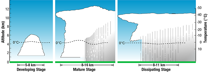
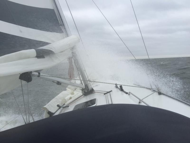
Sooner or later, the weight of all the moisture becomes too much for the rising air to support. Rain starts to fall, and with powerful, tall storms that have sucked up a huge quantity of moisture, the central column of falling rain (or ice) creates a downdraft of air moving at the same speed. When the rain hits the ground, the associated air column then turns horizontal and spreads out in all directions, forming surface winds typically in the 20-40 knot range, although winds over 60 knots are possible. Note that you can have the wind coming straight at you when you face the center of a thunderstorm in what I would call dump mode or the Mature Stage, even as the storm may be moving away from you. The winds will not last long, but even a few minutes of 30-50 knot winds will not prove to be an enjoyable experience.
It is essential to monitor the weather radar frequently on days when thunderstorms are forecast. The radar loops are 70 min long, and will give a clear picture of where the systems are headed and if they are still intensifying or petering out. Getting to a safe harbor in 30 minutes or so is crucial. If you do get caught out, all sails must be lowered well in advance or at the first sign of a gust. Dropping or rolling up sails while 40 knot winds have you pined down at a 30 or 40 degree angle is close to impossible. We use the Noaa Mobile site to track thunderstorms while on the water:
NOAA Mobile Weather
Note that we are in the ‘Marine Zone’ which extends to within about 10 miles of the greater Long Island Sound. This large body of water absorbs rather than reflects the suns energy, and typically as thunderstorms approach the Marine Zone, they begin to weaken. This is why Block Island, for example, almost never gets hit with thunderstorms.
Strong Cold Front
Another frequent weather phenomena which can be very dangerous with associated thunderstorms and winds often in excess of 40 knots is a strong cold front. These are especially common in the spring and fall, and are associated with a low pressure system. On the weather charts, a cold from is indicated by the tepee like structures on a line extending from the low.
The forecast discussion will always discuss the arrival of a strong cold front in details and again, make sure you are not on the water as the front approaches where you are. The Thunderstorms may die off as the front crosses the sound but the winds most certainly will not, and strong cold fronts can frequently sweep South and east more than 600 miles away from the parent low.
Wind Reports
The last source of info we look at all the time are local wind reports. Many of the local bouys and stations are down, and some always underrepresent the winds. The stations we look at most often are Kings Point, and New Haven. The link to Kings Point is;
Kings Point Station
The New Haven link is here;
New Haven Weather Station
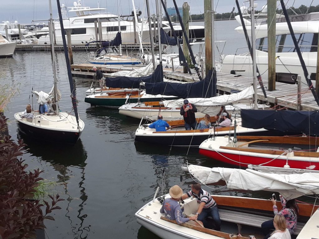
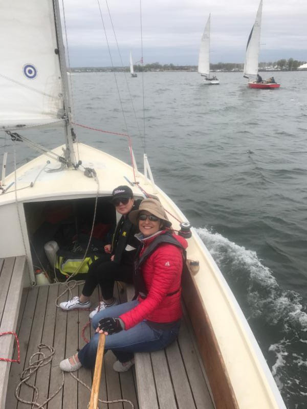
Racing Starts Again today, June 27th!
The racing series is open to all! Of course, one design racing is far and away the best way to refine your sailing skills, and learn how small differences in sail trim or steering have a big impact on speed. Plus learning to work together effectively as a team and grow is rewarding in any endeavor.
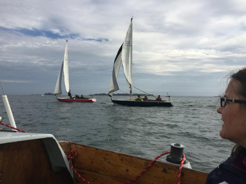
If you wish to steer, you must have completed our Intro to Sailing course. Each boat will have one or 2 captains, who will be SSC members. The SSC members will do the starts and about half the driving upwind and downwind. If you have completed the Intro courses, you will qualify as a helmsman and you can and will do some of the steering as we will rotate through positions. We try to set the courses to get in 4 or more starts, helping you refine your strategy on the line.

Boats start leaving the dock at 6:00 pm. We have in the past and will continue to offer women’s only boats as often as possible, along with singles boat if sufficient interest. Since we race close to the dock, you often can jump on a boat at any point up to the last race. The races will be cancelled if small craft warnings are posted, the winds are over 18 knots, gusts are over 22 knots, or there is moderate to heavy rain or lightning. We normally look at the New Haven and UConn Western Long Island Sound weather stations for wind strengths.
The Thursday evening racing series starts June 20th, and continues for every Thursday till mid-September, for a total of approx. 14 evenings. The cost is $20 per person for non-members, free for members unless you are the Captain (in which case the cost is $20). Members can invite one guest at the member rate (and additional guests at the non-member rate).
Fleet Update!
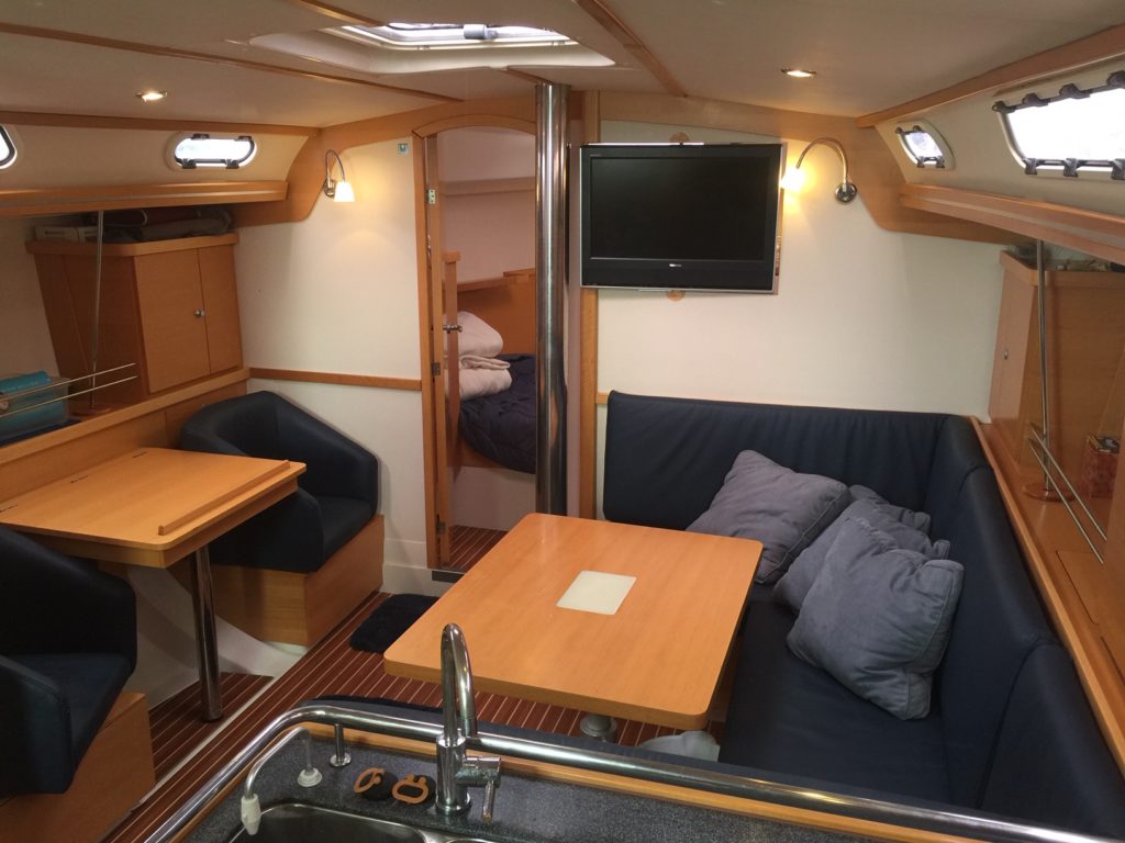
40 Class Our Var 37 is super clean and ready for your adventures in Norwalk. Valanta, our Hanse 400, is on her first summer cruise. One member is taking her to Martha’s Vineyard, then Newport, then another will bring her back to Mystic. The new rubrails will be installed next week. The plan is that the Hanse 400 will again head to Maine this summer, although there is a chance we will have the J44 ready instead. We have added lots of gear this week, including new aft cabin ports, LED running lights, etc. Let us know your summer plans and interest asap, especially if you wish to sail in Maine and Northern New England.
Varuna is available in Norwalk this Friday, from Sunday July 7 to Sunday July 14th, and from Tuesday July 16th to Sunday July 20th. Thereafter she heads to Mystic and becomes the Mystic 40 class yacht for the rest of July and all of August. There are no reservations from July 23 to August 17th.
Valanta is available from Tuesday, July 2nd to Friday July 12th. Then she is booked for the Class and with members sailing her in Maine. The next available pickup point date is August 19th in Rockland Maine. She should be brought south to the Mass area by August 26th.
35 Class The Sweden 340 has the new upholstery in, along with the new V berth and Main salon hatches and has already been out for several days. The Mystic based Contest 36 has been out on her first cruises to Newport and Block Island. Lots of availability. Her only reservations after July 19th are July 26-28 and Aug 2-4.
32 Class The C&C 32 is launched and back in service in Mystic. The next project for her is a rigid bimini with a solar panel. We painted the hull, cleaned the teak, etc. and she looks great! In Norwalk, the Pearson 37 is sailing. The CS 30 is hauled presently for service.
27 Class Please contact us if the Bristol 27.7 or any other class is of interest soon! The Bristol 27 is for sale, but can be used in the meantime.
Ensigns We have installed 4 new mains and 3 new electric motors, several new chargers, and almost all the boats have new bilge pumps. We have also started redoing the varnish, and repainted the interiors so they are looking better than ever!
Calendar
Every Sat / Sun Passport to Sailing, Intro or Basic Keelboat classes start at 8am and run to 1pm every Saturday and Sunday for the rest of the summer. Our best value is Intro and Basic Keelboat combined ($150 savings) here;
Combined Intro and Basic Keelboat
Keeping our bodies in shape is important, but keeping our minds sharp and in shape is just as important. The process of learning or expanding a new sport like sailing is beneficial not just for the relaxation and excitement that sailing provides, but your brain also experiences significant benefits thanks to the challenge of learning. Sailing and cruising is such a wonderful way to experience the world.
NY Times Article on Learning a New Sport
Wooden Boats Festival / Show – June 28th to 30th One of our favorite events at one of our favorite places, Mystic Seaport. This is a real treat for wooden boat lovers and sailors of all persuasions!
Basic Cruising Class – July 12th-14th Class The class starts next week with evening Session on July 8th and 10th (flexible). The class runs from 10am on Friday June 21st to 4 pm Saturday. Students then do a overnight sail to practice what they have learned. This class will run from Norwalk to Stamford to Eatons Neck / Huntington LI and then back to Norwalk.
Advanced Cruising Class – July 21-26th Class Advanced Cruising is full for 2019!
Again this year we will be sailing our Hanse 400 Valanta up north. Several members enjoyed Maine Cruising so much they have asked to do this again. Valanta has been reserved by members in Maine up to August 19th, when she is available for pickup in Rockland ME. Typically she is south of Cape Cod by early Sept.